The Next Hike

Check here every week for details on the next Trekker hike!

Friday, December 28, 2012

Next Hike

The next hike will be on Saturday, 29th December. 
We meet at the Ballpark in Gillies Bay at 10:00am 

Last week the hike day was another rainy one and the temperature was low enough that we were seeing sleet rather than rain for a while.  On much of the higher ground where we have hiking routes I'm sure walking would not be very pleasant with lots of wet snow on the ground just now.  We decided the best thing to do was just start from the ballpark and hike up through the forest to Cap Sheaf Lake.  Some sections of the trail were covered with quite a layer of small green branches a reminder that we have had some extremely strong gales in the last couple of weeks. At lunch time we were under some trees looking out over a marsh and frozen lake. It was cold and wet, but a least not windy as a breeze would have made things really uncomfortable. 
  
On a recent hike I could not resist taking some photos of an old Kenilworth dump truck belong to an island logging company.  This type of vehicle is used to transfer road building gravel from roadside pits out to the logging roads being repaired or extended into fresh logging areas.  I'm not sure how old this one actually is, but it does appear to have had many years of rough use. It looks like a good candidate for preservation in a museum!
JD.

A vintage Texada logging company dump truck for road building.

Friday, December 21, 2012

Next hike (2nd email)

This is a repeat of yesterday's email for those who were missed off the address list for that one.  I still was on Vancouver Island yesterday and was using an out of date version of the Trekkers group email list.

The next hike will be on Saturday, 22nd December.
We meet at the Ballpark in Gillies Bay at 10:00am.

Last week the weather was again quite windy, but the rain held off for much of the time. To avoid big trees and the strong winds we decided to just drive part way along the road to the airport, and then hike down to Cox's Lagoon.  I know from experience that the SE gales tend to bypass the shoreline there and that was indeed the case on Saturday.  Sitting on the logs for lunch was quite comfortable and we were entertained by a large group of seals and a couple of sea lions.
JD.

visit texadatrekkers at:   www.gilliesbay.ca 

Diana waving to the small group of Harbour Seal that were as curious about us as we were about them.

Thursday, December 20, 2012

Next Hike

The next hike will be on Saturday, 22nd December.
We meet at the Ballpark at Gillies Bay at 10:00am

Last week the weather was again quite windy, but the rain held off for much of the time. To avoid big trees and the strong winds we decided to just drive part way along the road to the airport, and then hike down to Cox's Lagoon.  I know from experience that the SE gales tend to bypass the shoreline there and that was indeed the case on Saturday.  Sitting on the logs for lunch was quite comfortable and we were entertained by a large group of seals and a couple of sea lions.

I'm not on Texada today and don't have any recent hike photos with me, so here is one from a couple of years ago. It was winter time and at a point on the trail where we had stopped for a 'nature moment' and your "Intrepid Leader" was explaining the curious material surrounding a steel drill pipe which had become an artisian well. The water had been overflowing from the open top and a substance called 'tufa' had built up totally covering the pipe.  You can Google the word to get a simple explanation of this with a few photos of larger and more natural examples.

Happy Christmas everybody!  
JD.

visit texadatrekkers     on   www.gilliesbay.ca 


Friday, December 14, 2012

Next Hike

The next hike will be on Saturday, 15th December.
We meet at the Ballpark in Gillies Bay at 10:00am.

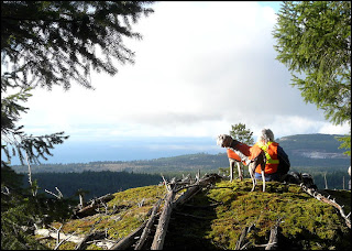
Last week we had quite a nice day for hiking although there was a fair amount of mist around, especially on the higher ground.  We drove south towards Shingle Beach, but turned left after the Stromberg Creek bridge and headed up past the parking place for the water falls until we got to the side road on the left that was to be the start of our hike to Thompson Bluffs.  The old logging road that climbs steadily up through the forest was fine and we made good progress until we had to branch off onto the now overgrown trail that we first opened up many years ago.  It climbs quite steeply at first and the trail is so overgrown with salal and evergreen huck that we made very slow progress, even getting off the trail at one point where a small stream runs down the track of an old skidder road.  By the time we reached Thompson Road it was getting close to lunch time so the idea of going on up onto the bluffs was dropped and we looked for a viewpoint not so far away.  This worked out well and we sat on a mossy high spot with a view out over the north-west end of Lasqueti Island while eating our picnic lunches.  
JD.

          
  A misty view from our lunch spot close to Thompson Road.

Friday, December 7, 2012

Next Hike

The next hike will be on Saturday, 8th December.
We meet at the Ballpark in Gillies Bay at 10:00am

Last week our hike day was a rainy one, but more than the usual number of intrepid hikers showed up at the meeting place. I decided to break the hike up into three parts to keep the time spent in the rain to a minimum.  First we drove south past Davie Bay and then up the side road to do a quick visit to Stromberg Falls.  As usual in recent years there is still not as much water coming over the falls as there used to be, but quite enough to impress those who were seeing them for the first time.  From there we drove back down the hill to the bridge and then parked again a short distance along the Shingle Beach Rd. Instead of going the full distance we branched off onto the short road down to Yew Tree Bay.  The cabin there is a mess now and would not be a pleasant place to eat lunch, but the next little cove to the north was sheltered from the wind and we sat under the big Arbutus trees there instead. Returning to the vehicles we finally made the neat little beach our third destination, some call it Secret Beach, where Stromberg Creek reaches the sea.  
While being close to the sea for parts of the hike we were not lucky enough this time to see any of our less common marine mammals although I remember one day sitting eating lunch at the little cove near Yew Tree Bay and being entertained by a small gang of Sealions only a stone's throw out from the beach.  However, one morning just three weeks ago, I saw a small pod of our resident Pacific White-sided Dolphin rushing across the middle of Gillies Bay. They were too far away for me to get a good photo, but one of our hikers was much closer to them and got this amazing action shot. Thanks Justin!   

Texada Holiday Potluck Gala

Texada Island Community Society will be preparing turkey, stuffing, gravy and ham. We ask attendees to make their favourite side dish or dessert, and join us Sunday, Dec. 9 at the Community Hall. Doors will open at 5:30 pm, and we will aim to start eating about 6 pm. The event will be licensed, but no Ubrew or homemade spirits are allowed (store bought only). We will be checking.  Also, no minors.

There will be a collection area for the Texada food bank and Christmas hampers. Please bring a non-perishable food item if you can.  

If you plan to go, and have not already done so, please let Linda Bruhn know by Friday.   604-483-1471    email: texadasf@gmail.com

JD.

Pacific White-sided Dolphin close to the shore in Gillies Bay.              Justin Debbink photo.

Friday, November 30, 2012

Next Hike

The next hike will be on Saturday, 1st December.
We meet at the Ballpark in Gillies Bay at 10:00am.

Last week the morning was cool and damp, but there was not much wind and we decided to explore a bluff we had first visited last year.  We had done a little work then on the trail which follows an old logging road, but did not reach the far end for lack of time.  This time we had a chance to go a bit further and found we had a higher ridge on our right that looked as if there might be a good viewpoint on top of it.  It was steep after we left the road, but to everyone's delight when we reached the very top the morning's fog had lifted and we had a great view to the west.  Eating lunch was a pleasure as the sun was warming both us and the mossy slope of the ridge, making faint rising clouds of steam full of tiny insects sparkle in the sun light.
On our return route after lunch we flagged a much better way of reaching the new viewpoint that avoided the very steep climb to the new viewpoint at the northern end of the ridge.
JD.

The view west from Pocahontas Bluffs with Vancouver Island faintly visible in the far distance. 

Friday, November 23, 2012

Next Hike

The next hike will be on Saturday, 24th November.
We meet at the Ballpark in Gillies Bay at 10:00am.

Last week we had rainy weather for the start of the hike, but it dried up at lunch time. We parked near Second Lake and hiked up past the Reactor Station on the Vancvouver Island Hydro line, but backtracked when we found ourselves in fog with a nasty cold wind blowing up the hillside from Davie Bay. This time it looks as if we will have quite nice weather for a change.
JD.

Friday, November 16, 2012

Next Hike

The next hike will be on 17th November, 2012.
We meet at the Ballpark in Gillies Bay at 10:00am.

Last week we were very lucky to have a bright sunny day, the last of three days that I think were very much nicer than the days before and after the brief dry spell.  We met in Van Anda for a change and with a larger than usual turnout car-pooled over to James Mack's property on the west side of the island.  Taking the main trail south we headed uphill past the turnoff to Favada Point and then only the short distance beyond to the trail that runs downhill to Cabin Cove. Turning left not far from the beach we enjoyed the view of Cabin Cove from the bluffs as we followed the long winding trail past Arbutus Arch and on towards Big Beach.  The lunch spot on the grassy slope just above the beach is one of the few places where our trails give the hiker a good view of quite a long stretch of coastline.  It really is very rugged with continuous high and low cliffs that are quite unbroken by the slightest beach between Cabin Cove and Big Beach. 
For our return route we headed uphill to the very start of the Big BeachTrail and then north on the old logging road back to our starting point.  I was pleased to see a few sealions out on the outer side of the isalnds near Maple Bay and hope to see many more showing up in the New Year.  
JD. 


Lunch in the bright sun on the low cliff above Big Beach.  

Last week I had some problems with sending out the hike emails and a few people failed to get theirs.   You can always view earlier hike notices and photos on the Texada Trekkers web site here:—


Sometimes clicking on the old photos will bring them up to full size. 

Friday, November 9, 2012

Next hike from Van Anda

The next hike will be on Saturday, 10th November.
This week we will meet at 10:00am in the parking lot at the Canadian Legion in Van Anda
Last week we had another rainy day for our hike and while the rain was never very heavy it did pretty well keep up the whole time we were hiking. We drove to the start of the Mt. Pocahontas trail a short distance down the Pocahontas Bay Road.  This year has been a poor one so far for mushrooms and it was odd to be hiking along this forested route with hardly a single fungus to be seen anywhere, and yet water has been falling from the sky for several weeks and one would think the underground parts of the fungi, the mycelium, would be well watered by now.  We climbed steadily higher along the winding road, past the side trail to the peak where the fire lookout hut used to be and only then began to spot the odd golden yellow fungus pushing through the mossy forest floor.  This is the choice Chanterelle of which there are a number of varieties and species but Cantharellus cibarius seems to be the most common one. We finally reached the lunch spot, a grassy bluff overlooking Malaspina Strait which was to our surprise visible even with mist and rain cloud all around and above us.
JD.

  
  Golden chanterelles on the mossy forest floor on Mt. Pocahontas.

Friday, November 2, 2012

Next Hike

The next hike will be on Saturday, 3rd November.
We meet at the Ballpark in Gillies Bay at 10:00am.

Last week the rain continued on and off all week with rain still falling when we met for the hike in Gillies Bay.  From past experience we knew conditions for off-road hiking would be miserable so it was decided to stick to the good logging roads this time and sharing two vehicles we headed down past Davie Bay and parked not far past Stromberg Creek bridge.  For lunch we made good use of one of the rustic structures built for the annual Diversity Music Festival.  To give us comfortable seating we manhandled a wood picnic table up from the beach while one hiker found a wide shelf tucked up under the roof a more satisfactory perch.  Looking out past the trees we could see the Sabine Channel was covered in white caps driven by a strong south-easter so it was nice to be out of the rain and the wind as well.
The rain had eased off by the time we started back up the road to the vehicles and the hike turned out to be quite a pleasant one in the end.
JD.

    Hikers sheltering from the rain at Shingle Beach Campground.

Friday, October 26, 2012

Next Hike

The next hike will be on Saturday, 27th October.
We meet at the Ballpark in Gillies Bay at 10:00am.

Last week we drove part way up from Davie Bay Rd. towards Thompson Rd. and parked just past the old sandpit. From here the old logging roads take us quite steeply up through the forest onto Thompson Rd. where it runs quite level towards the south. At the next junction we turned south onto the road we had been driving on  before we parked, then right again onto the fairly new logging road that climbs very steeply to the top of Eagle Mountain.  We used the usual grassy bluff for lunch, but then later discovered that there was a much better viewpoint on a grassy bluff that we could reach by going through a narrow belt of trees to the north of where we had been sitting. 
My photo taken from that viewpoint is a long telephoto shot that really compresses the scene.  In the foreground is Gillies Bay with the Lafarge Quarry beyond it in the middle distance. The black pile on the beach below the quarry workings is coal awaiting shipment to the Far East. This is brought over from the coal mines on Vancouver Island on barges that are loaded in Campbell River. The peak on the right is Surprise Mountain and beyond it and just visible in the far distance is Comox Airport.
JD.


   The fine view from the new viewpoint on Eagle Mountain.

Thursday, October 18, 2012

Next Hike

The next hike will be on Saturday, 20th October.
We meet at the Ballpark in Gillies Bay at 10:00am

Last week we were lucky we had no rain again while we were hiking, but there was thick fog on the higher ground and clouds everywhere.  We drove up into the fog on Bell Road then headed north and down to the White Pine test area where we parked just before the Russ Creek bridge.  The forest along the old logging roads is quite impressive in this area and there were hikers that recall that in recent years they have collected some fine mushrooms from the forest floor.  This year the long dry spell in the summer has meant that fungi of all kinds are almost nowhere to be seen, at least not yet, but the heavy rain this week may get things moving along underground and produce the above ground fruiting bodies we love to gather. Our lunch spot was on Taylor Bluff where we could just make out part of the mainland coast line where it was not covered in fog.
My photo this week is of another edible product of the forest on Texada, the berries of Evergreen Huckleberry, Vaccinium ovatum.   This year they seem to be especially juicy and sweet and should be good to pick and eat for quite a few weeks.  I find it curious that not many birds eat these berries, but where the fruit is growing on branches close to the ground the racoons do consume quite a lot of them.  Grouse no doubt pick off ones growing low enough for them to reach, but deer seem to avoid them. 
JD.

A cluster of the fruit of the Evergreen Huckleberry, a tasty treat at this time of the year.

Friday, October 12, 2012

Next Hike

The next hike will be on Saturday, 13th October.
We meet at the Ballpark in Gillies Bay at 10:00am.

Last week we had a wonderful dry sunny day for the hike and chose to revist Mt. Grant knowing that the various viewpoints would offer clear views in all directions. This year we had so many rainy days in spring and well into summer that it seemed as if our regular dry warm days would never arrive. Eventually the normal summer weather did start, but much later than usual and then continued on and on right through September and into October. Finally, as I write this the weather has changed, the sun is behind a thick cloud cover and the forecast is for some rainy days soon. Dig out the rain gear and start dressing more warmly!  
JD.

At one of the viewpoints on the Mt. Grant Trail on a lovely dry sunny day early in October. 

Friday, October 5, 2012

Next hike

The next hike will be on Saturday, 6th October.
We meet at the Ballpark in Gillies Bay at 10:00am.

Last week we decided to do some exploring again and headed south up onto the high ground and all the way down the Cook Bay Road finally parking at the gated entrance to the large private property. Taking the road to the beach that starts at the gate we hiked downhill to a pont where we seemed to be close to the extensive area of open bluffs I knew extended between the road and the coastline to the south west.  At first we were following winding deer trails through open forest that eventually opened out onto grassy areas and we found if easy to climb to a high spot we could see on the GPS.  None of us had been into this area ever before and it was very pleasant to sit in the sun to eating lunch and looking down on Lasqueti Island from a different viewpoint. 
 
Instead of returning by the same route we used to reach the high point we decided to return to the road a different way and found we had problems with steep cliffs and patches of dense vegetation.  My photo shows just how hard it can be to make a new trail through dense evergreen huckleberry, Vaccinium ovatum.  This is not to be confused with the related red huckleberry, Vaccinium parvifolium, which is a smaller deciduous shrub not nearly as common on Texada as the evergreen species. Both have edible berries and both are tasty, but the black ones are less tart than the red.
JD.  

Cutting a new trail though a particularly tall patch of Evergreen Huckleberry. 


Friday, September 28, 2012

Next Hike

The next hike will be on Saturday, 29th September.
We meet at the Ballpark in Gillies Bay at 10:00am

Last week we had a dull cloudy day for the hike and decided to check out an old logging road near Hydro East.  As we approached the highest point on the Hydro East road we found ourselves driving through dense fog with no view of the coastal mountains at all.  We only came out of the fog as we reached our parking place at the roadside gravel pits.  Hiking on the side road that leads up to the Vancouver Island Hydro line we eventually came to the start of the old logging road that shows on the map as climbing steadily higher until it joins the Anderson Bay Road at Bobs Lake.  It proved to be fairly slow going as there are branches and trees blocking progress that need to be cut or avoided.  The road bed is in good shape and maybe one day we will spend some more time clearing the way so we can reach the nice viewpoint that we visit sometimes by hiking down from Bobs Lake. 
My photo this week is of a curious caterpillar I photographed a few days ago in my garden.  I'm still working on the identification, but I believe it's a moth called White-blotched Heterocampa, Heterocampa umbrata.  Getting it right is difficult because these caterpillars can change their colour patterns as they grow and the variety of patterns and colours within each species is very great.  Whatever it proves to be it's certainly a curious creature.
JD.

       
    A moth caterpillar, perhaps the White-blotched Heterocampa. [Heterocampa umbrata] 

Thursday, September 20, 2012

Next Hike.

The next hike will be on Saturday, 20th September.
We meet at the Ballpark in Gillies Bay at 10:00am.

Last week we hiked to the top of Mt. Davies in unusually warm sunny weather for mid September.  My photo this week is one I took earlier in the month when we hiked along Thompson Road and up to a small shallow lake not far north-east of Thompson Bluffs.  In my experience this fairly level stretch of Thompson Road in this area has just the right conditions in the warmer months to see and photograph butterflies.  Sure enough, although it's getting late to be seeing many of these lovely but quite fragile insects, I did get a few shots of a fresh looking Pine White.  This species is locally common on Texada and most often seen at higher elevations.  The eggs are usually laid on the needles on the top branches of pine trees and the adults are mainly seen in mid to late summer.  Males and females have different wing markings with the males having white wings with sharply contrasting black blotches and veins.  The fresh looking male specimen in my photo is missing part of one wing which may have been grabbed by a bird hoping for a tasty treat.  
JD.

 Male Pine White feeding on a flower on the side of Thompson Road.        

Friday, September 14, 2012

Next Hike

The next hike will be on Saturday, 15th September.
We meet at the Ballpark at Gillies Bay at 10:00am

Last week we drove up to Thompson Road and hiked south turning off on the side road that leads to Mystery Lake.  Before reaching the lake there is a fork in the road where we often strike off onto a narrow winding trail that climbs to the viewpoint on Thompson Bluffs.  This time, and to make a change we took the right fork which climbs steeply for a short distance and then ends in the forest.  Quite a few years ago we had visited a small lake in this area, but reached it from the south side by a different route than we were on this day.  From the road end we bush-wacked east and eventually reached a narrow bluff on the north side of the lake which made a pleasant spot for the lunch break.  On the earlier visit some of the hikers tried sitting on apparently solid logs for lunch, only to have them crack more than once. It seems  appropriate to name the tranquil spot Broken Logs Lake.
My photo was taken from the lunch spot and shows how shallow it is as water lily leaves dot almost the entire surface, and this common aquatic plant is restricted to quite shallow water. 
JD.

The shallow Broken Logs Lake a short distance east of Thompson Bluffs. The leaves dotting the surface are water lilies.

Thursday, September 6, 2012

Next Hike

The next hike will be on Saturday, 8th September.
We meet at the Ballpark at Gillies Bay at 10:00am.

Last week we again had lovely weather for hiking and headed south past Bobs Lake to park on the gasline beyond Angel Lake.  Hiking south along the right of way took us quite soon to the start of the Twin Peaks Trail.  The pleasant temperature in the shade of the forest seemed to make the steep climb less hard work than usual. For lunch we chose the north viewpoint for a change and this is where I took my photo of the week with this rugged, dead and leafless tree framing the view over the Sabine Channel to Lasqueti and the Vancouver Island mountains in the far distance.  
JD.

The wind beaten ragged tree at the north viewpoint on Twin Peaks.

Friday, August 31, 2012

Next Hike

The next hike will be on Saturday, 2nd September.
We meet at the Ballpark in Gillies Bay at 10:00am.

Last Saturday we drove north towards Van Anda then turning off on Priest Lake Hill we took the winding road that eventuially reaches Kirk Lake.  This deep lake which sits in quite a steep sided valley between two heavily wooded hills is surrounded by private land with no public access, but our destination was the high ridge to the north of the lake which can be reached on logging roads that run through crown land. The roads are in very good condition and provide pleasant walking for more than half an hour until the start of the forest trail is reached.  This meanders from one open area to another as the hiker climbs towards the top of the ridge.  On a couple of steep sections the bone dry arbutus leaves make it hard to avoid slipping, so care has to be taken. A viewpoint not long before the high point offers views east to Malaspina Strait, the coastline south of Powell River and the mainland mountains.  On top of the ridge the open areas provide easy walking heading west until the lunch spot is reached where the bluff drops off steeply and provides a great view of the Georgia Strait, the cliffs below Comox Airport and the snow capped Vancouver Island Mountains. If the recently announced plans to establish a park reserve north and south of Favada Point work out then most of the forested area with rocky outcrops in the centre of my photo will one day become parkland with unrestricted public access.
JD.

An archive of my hike emails may be visited at:—  http://texadatrekkers.blogspot.ca/   Clicking the photos will often bring up larger versions which can be saved if you wish.

 The view west from Kirk Lake Bluffs towards Comox and the Vancouver Island Mountains.      

Friday, August 24, 2012

Next Hike

The next hike will be on Saturday, 25thAugust.
We meet at the Ballpark in Gillies Bay at 10:00am.

Last week we hiked from the Airport Road to Sandbanks then along the beach and back past the Airport  to the parking place.  The sea was calm and visibility very good, but I was disappointed to find there were no Harbour Porpoise to be seen and hardly a single sea bird.  The tide was quite low and as we walked across the eelgrass beds at Cox Lagoon it was a bit of a surprise to see a good sized Garter Snake working it's way between the barnacle encrusted rocks.  This species does swim well so there was danger of it drowning when the tide came in.  It was curious to see that it had captured a small frog and I think it unusual for frogs to be seen on a beach, certainly not what I would expect at all.
JD.

A Garter Snake with captured frog well out on the beach near the airport.

Friday, August 17, 2012

Next hike.

The next hike will be on Saturday, 18th August.
We meet at the Ballpark in Gillies Bay at 10:00am.

On a recent hike to Balanced Rock Lake and the Thompson Road area we explored a line of bluffs on the south side of Mystery Lake.  On one of the bluffs we visited I spotted a lone specimen of the species of juniper that grows in open areas on the higher parts of the island. It was probably a fairly young shrub, but because it had been regularly browsed by deer it was small and very compact in shape.  It looked as if it had been tended by a meticulous japanese gardener so I call it a 'bonsai' juniper. An interesting fact about this species, Juniperus communis, is that it's the most widespread woody shrub in the world.  It's found in the temperate regions of the Northern Hemisphere not only in North America and Europe, but right across Asia to the Pacific.  
JD.

A 'bonzai' juniper on a bluff near Mystery Lake. 

Thursday, August 9, 2012

Next Hike

The next hike will be on Saturday, 11th August.
We meet at the Ballpark in Gillies Bay at 10:00am.

Last Saturday morning the weather seemed to be warmer than ever and I had requests for a hike that would not include much walking in the full sun.  I choose our popular Black Mountain hike judging, correctly as it turned out, that much of the route would be in shade from the forest both along the logging roads and on the off road trail. Trouble was even in the shade it was pretty hot and the bugs were unusually troublesome especially the deerfly.  As we climbed up the steep trail towards the top of the mountain we sweated and wished a nice cool breeze would greet us at the top.  Sure enough, at the shady lunchspot overlooking Malaspina Strait there was a gentle breeze making it quite pleasant to sit and eat lunch in comfort. 
 
 I think my photo is appropriate for this hot weather as it shows a very smug looking Bullfrog sitting half submerged on a Priest Lake water lily pad. 

     
      A non native Bullfrog keeping cool and wet on a water lily leaf at Priest Lake.    

Friday, August 3, 2012

Next Hike

The next hike will be on Saturday, 4th August.
We meet at the Ballpark in Gillies Bay at 10:00am

There was no hike last week.  Towards the end of a hike earlier in the month we had almost got back to the vehicles when we noticed a female grouse with some chicks in the dry grass at the roadside.  The chicks ran off in different directions as we approached and the mother felt we were too much of a threat to be ignored.  She took to the air and launched an airborne attack almost hitting one of us before eventually landing on a branch where she could keep an eye on us.  Meanwhile the chicks had disappeared into the underbrush and the mother soon became calm making it quite easy for me to get this nice shot from below. 

I always wondered why our only species of grouse is called Blue Grouse when there appeared to me to be nothing blue about the bird at all.  The neck skin patches that I once saw on a male during mating season were orange coloured, but it seems that the males of this species living east of the rockies have purple coloured neck patches. 
JD.    

The female Blue Grouse that stoutly defended her chicks from the attacking hikers. 

Friday, July 27, 2012

The Next Hike is cancelled for this week only.

The Texada Trekkers hike is cancelled this Saturday only. 
Last Saturday was Sandcastle parade day so only a very small group came on the hike.  We followed a circular route from the Community Hall that took us up into the forest behind Gillies Bay and high onto a grassy bluff with a view over the community and bay below. After lunch we followed my old trail marked with rock piles and flagging that heads south over some more attractive bluffs and through small patches of brush until it joins the well used Cap Sheaf Trail at the south end of a long narrow swamp. Following this almost to the Ball Park we turned right at the bottom of the long hill and returned to the Community Hall on the old logging roads behind Gillies Bay.  
 
My photo this week is a striking insect which goes by the name of Eyed Elater Beetle or Alaus oculatus.  It's quite large, up to two inches long, and has a couple of fake eyes on it's body that have evolved as a defense against predators. I did not realise until later that it's actually a very large click beetle so if it gets turned on it's back it can spring into the air with a sharp click and get right-side up again instantly. It's larval form feeds in rotting wood on the grubs of some insects that are pests of useful timber trees. 
JD.

Eyed Elater Beetle.  This is a very large species of click beetle.

Thursday, July 19, 2012

Next Hike - meet at the Community Hall.

It's Sandcastle Weekend coming up and our meeting place is the Community Hall in Gillies Bay to avoid the congestion at the Ballpark.
We meet at the usual time of 10:00am, Saturday 21st July.

Last week we had warm dry weather for our hike and drove along dusty Bell Road parking about a kilometre north of Bobs Lake. It was pleasant hiking along the logging roads around the lake and south towards Angel Lake before heading into the campground for lunch.  My photo shows some of the hikers chatting in the shade beside the lake before heading back to the vehicles.
JD.

   
  Hikers chatting in the cool shade after lunch at Bobs Lake camp site. 

Friday, July 6, 2012

Next Hike

The next hike will be on Saturday, 7th July.
We meet at the Ballpark in Gillies Bay at 10:00am

Last week the hike day was overcast and rainy all morning only becoming dry after our hike was over.  When the forecast is poor and the rain seems likely to last we try to stick to roads instead of hiking the narrow trails where getting soaked from head to toe is bound to be the uncomfortable outcome.  A suitable choice where the hiking is much more comfortable and the umbrella put to good use is the hike along the road to Shingle Beach where the Diversity bandstand provides a nice dry location for lunch.  
My photo this time is of a female Western Painted Turtle that was busy last week looking for a suitable spot to dig a nest hole not far from the shore of Priest Lake. It was early evening and I was photographing and recording the recent digging activity of our largest reptile.  This is now considered to be a species at risk and there is funding available for research and habitat protection on Texada and elsewhere in coastal BC.  At Priest Lake there seems to be a fairly healthy population and judging by the number of nest holes I counted this time they may actually be increasing in numbers a little bit.  
JD.
 
  
   A female Western Painted Turtle checking out the nesting area at Priest Lake. Texada Island.

Friday, June 29, 2012

Next Hike.

The next hike will be on Saturday, 30th June.
We meet at the Ballpark in Gillies Bay at 10:00am.

Last week we had very pleasant weather for our hike.  June this year has been cooler and has had more rainy days than usual so it's nice when a hike day turns out well. We drove towards Davie Bay and parked at Eagle Creek in a spot that is barely recognisable after so much logging has taken place in such a short time. This is crown land and it bothers me when I see old style clearcuts of public land in contrast to the more carefully logged private forest owned by Texada Forest Reserve.  The hikers included a family from the interior who were happy to visit the Mouat bluffs with views of the straits and the smaller islands followed by lunch on the rocky beach at the south end of Mouat Bay.  The youngsters especially liked the rock hunting on the beach and managed to find a few examples of our distinctive "flower rock".  My photo was taken on a hike earlier in the month when I spotted a lone rose bush with a pair of almost perfect blooms.  
JD.

        
A pair of wild rose flowers beside the beach near the Sandbanks not far from Gillies Bay.

Friday, June 22, 2012

Next Hike

The next hike will be on Saturday, 23rd June.
We meet at the Ballpark in Gillies Bay at 10am.

On a recent hike I photographed a very distinctive type of fungus that is quite unmistakable in appearance.  It's really quite common, but being so small it probably gets overllooked by many people.  The very odd shape is rather like a very tiny china teacup of the type that have no handle, and the contents of the cup look like miniature flying saucers which, in a way, they really do become. The brownish "eggs" in these tiny nests are actually the spore cases which are dispersed when rain drops land on them and flip them out to some distance away from the cup where they were produced.  In my photo you can see a couple of empty grey spore cases resting on the bark.  There are several species of Birds Nest Fungus in our area and I don't know whether or not this one might be the more common Nidula candida.
JD.


Birds Nest Fungus with and without spore case "eggs".

Friday, June 15, 2012

Next Hike

The next hike will be on Saturday, 16th June.
We meet at the Ballpark in Gillies Bay at 10:00am

Last week we hiked in excellent weather up to the viewpoint to the east of the Pocahontas fire lookout peak.  Actually the small white wood building is long gone and all that is left of it now is some rusty metal and the concrete foundations. But the name has remained and the trail to the top is in good shape.  We were headed a little further to the east this time so we gave the lookout side trail a miss.
The previous week we had hiked along the beach from Sandbanks to Cox Lagoon and my photo shows the wide expanse of sand and rocks that is exposed below the sand cliffs at our lowest low tides.
JD.

 
The beach at the Sandbanks near Gillies Bay on a day with a very low tide.

Friday, June 8, 2012

Next Hike

The next hike will be on Saturday, 9th June.
We meet at the Ballpark in Gillies Bay at 10:00am 

Last Saturday we started our hike from quite close to our meeting place only driving up the Airport Road as far as Cranby Lake.  From there we followed very pleasant grassy logging roads and eventully took the steep trail down to the beach at Sandbanks. The tide was extremely low and it was a good opportunity to wander around checking the tidepools and seeing what the falling tide had left behind. Walking north along the rocky beach as far as Cox Lagoon we found increasing numbers of tent caterpillars and under the alder trees on the trail up to the airport there were even more.  

My photo this week was taken on the hike we did a couple of weeks ago that took us up onto bluffs high above Cook Bay.  Our lunch spot was on a steep slope above the Sabine Channel with good views towards Vancouver Island. We don't often get this far south on Texada on our weekly hikes and it gave us quite a close view of Jedediah Island which became a Provincial Park in 1994 after a small group of Lasqueti Island residents had raised more than four million dollars towards it's purchase by theProvincial Government.
JD,

 
The view south from a bluff above Cook Bay. Jedediah is the closest of the large islands and Vancouver Island is in the far distance.

Friday, June 1, 2012

Next Hike

The next hike will be on Saturday, 2nd June.
We meet at the Ballpark in Gillies Bay at 10:00am.

Last Saturday we had a long drive to reach our starting point near the bottom of the long hill down to the gate at the entrance to the Cook Bay private property.  The road here has recently been upgraded, widened and with new ditches dug along both sides.  For a short distance along one ditch the bank was damp, but had very little vegetation cover and for some reason was very attractive to a species of small blue butterflies.  I don't think I have ever seen so many of them gathered in one place before.  It reminded me of sunny clearings in the rain forest in Africa where puddles of water would sometimes attract masses of butterflies of many species.  I managed to get photos of these hyperactive blues at rest, but when in the air they moved so fast I found it impossible to get shots of the bright blue dorsal surface of the wings.  Later I identified them from the photos as the common Spring Azure, Celastrina argeolus.  This species is also found in Europe and was given it's latin name by Linnaeus way back in 1780 so it's certainly not rare or unusual.
The females lay their eggs on the flowers of shrubs, often Arbutus, ocean spray and elderberry in our area.  When the eggs hatch into caterpillars they are often looked after by ants which are rewarded when the larvae release drops of tasty fluid from their body.  What a curious symbiotic relationship!
JD.

Three Spring Azure blues attracted to a seepage area along a roadside ditch near Cook Bay.
    

Thursday, May 24, 2012

Next Hike

The next hike will be on Saturday, 26th May.
We meet at the Ballpark in Gillies Bay at 10:00am.

Last Saturday we had a larger than usual group of hikers including a couple from a small seaside town near Edinburgh on the east coast of Scotland.  The weather was perfect for hiking and we headed up past the  Vancouver Island hydro lines to park at the usual spot on the pipeline right of way.  Walking south then through the forest to the other Bobs Lake road we headed for the best high elevation viewpoint ahead on the very top of Mt. Davies.   It was too hazy to see as far as Mt. Baker, but the coast ranges on the mainland and the Vancouver Island mountains were quite visible and the visitors were suitably impressed.  My photo is of the hikers after the lunch break on the summit was over.
JD.

  
A happy group of hikers on the summit of Mt. Davies.

Friday, May 18, 2012

Next Hike

The next hike will be on Saturday, 19th May.
We meet at the Ballpark in Gillies Bay at 10:00am.

Last week we drove over to Pocahontas Bay and south on the the old Pocahontas Main logging road parking just before Russ Creek.  From there we hiked south on the spur road that heads down the east side of Texada and reached the very end of the road only a few metres above sea level, but still in the forest.  I had hoped the road would end right at the beach, but it turned out that there was a thick tangle of mainly evergreen huck between the end of the road and the two pocket beaches that we had seen on Google Earth. Perhaps on another day we will bring some tools along and cut a trail to the beach and have lunch sitting on the beach logs in the sun. 
I took today's photo through a gap in the forest about half way up the long steady climb back to the parking place.  
JD.

 
The view of Malaspina Strait with Nelson Island and the snow covered Coast Mountains beyond.

Friday, May 11, 2012

Next Hike

The next hike will be on Saturday, 12th May.
We meet at the Ballpark in Gillies Bay at 10:00am.

Last Saturday we had an extra low tide and decided to visit the beach at Davie Bay to see what we might find there.  As it happened there were few tide pools to explore and hardly any sandy patches exposed and we didn't find anything much unusual.  Unlike beaches in other parts of the world, in Europe in particular, our beaches are almost totally free from garbage and man-made pollution of the very worst kind.  I'm thinking in particular about tar and heavy oil that so often ends up washing ashore in areas with heavy marine traffic.  Please consider signing the message on the web site below to make Victoria aware of your views.  I understand it helps if you type in a few words of your own at the top of the message window which comes up if you first enter your contact information.  

JD.

           
The beach at Davie Bay is clean and oil free now, but the plan to build a loading dock on the right side of the island in the photo will bring tugs close to 
dangerous underwater rocks. 


Friday, May 4, 2012

Next Hike

The next hike will be on Saturday, 5th May.
We meet at the Ballpark in Gillies Bay at 10:00am.

Last week we had dull cloudy weather with a very unpleasantly cold wind for our hike.  We decided to explore an area to the north of Russ Creek where quite a lot of logging has been going on over the last year or more.  Our first attempt to explore a new road lead very quickly to a dead end in the middle of a very large clearcut, so we reversed direction and returned to our vehicles.  It had been far from comfortable walking in a very open area with such a cold wind blowing and we were glad to drive downhill into the forest hoping that our next new logging road would be less windy.  Parking at the start of a recently rebuilt logging road on the left we started on what proved to be a very long uphill climb that took us along winding roads nearly 700 ft  higher.  This certainly warmed us up very nicely and we were lucky to find a lunch spot beside an active beaver dam with no wind at all.  However, the very surprising thing was that the still air was full of tiny gnats that swarmed around us as if it was a hot summer day! The beaver lodge was quite a new one and there were fresh beaver paths going off in different directions from the dam.  Not far away was a lake without a name that we have hiked to a couple of times in the last two years.  
My photo was taken on the new logging road near the top of the ridge not far from the end. 
JD.

Hiking the long new logging road that ended not far from a beaver pond on the far side of the ridge at the top of the picture. 

Friday, April 27, 2012

Next Hike,

The next hike will be on Saturday, 28th April.
We meet at the Ballpark in Gillies Bay at 10:00am.

On our last weekend hike we were in the central Thompson Road area and had lunch on top of the very steep sided Eagle Mountain. There is a fairly recent logging road that climbs very steeply to the very top and some grassy bluffs on the west side have great views towards Vancouver Island.

Sometimes on our hikes someone will spot some natural feature along the way and mention that it would make a really pretty photograph. The only trouble with that is that capturing the scene with the camera lens can be far from easy. The human eye sees the world in 3D and the brain often hides the background in a way that works in the real world, but not so well with a two dimensional picture. The subject of my photo this week is an upended tree stump that has been nicely decorated by nature. One of the hikers noticed it as we walked past a shallow pool and I have tried to portray the beauty of the moss, the lichen, the bark and the miniature tree in my photo.
JD.

Thursday, April 19, 2012

Next Hike

The next hike will be on Saturday, 21st April.
We meet at the Ballpark in Gillies Bay at 10:00am

Last week we had a very pleasant day, mild temperature and calm sunny conditions for our hike.  We decided to drive up onto the high plateau area to the south of Bobs Lake as we were sure the snow which had kept us away for some time would be all gone by now.  We parked not far from Angel Lake and took a side road the short distance to the southern part of Gentian Lake.  This was just to take a quick look at the flooded road which some of us had not seen before and, in my case, had not checked out for several years.  We wondered if it was still a barrier to hiking.  Retracing our steps and after walking south on the main road for a while we sidetracked again to pay a quick visit to the picnic area beside Angel Lake.  Being far too early for lunch we continued south and headed in the direction of the hunters camp beside a large beaver pond where we had recently finished cutting a trail I started quite a few years ago with Sylvia Dunn.  As we crossed a boggy area on the old part of the trail one hiker spotted and caught a good sized frog that was quickly identified as a rare Red-legged Frog.  In Canada this species is only found on Vancouver Island, a small part of the adjacent mainland and a few islands in between. On Texada the species in recent years has only been found from Gillies Bay north to Blubber Bay so it is exciting to find that it also still survives on high ground in the south.  We were lucky that this individual was very docile as they tend to be fast moving and hard to catch and certainly not easy to photograph.  In my photo below it's sitting on the lovely red variety of Sphagnum moss where we found it. You can clearly see the golden eyes that are a distinct feature of this species, but the bright red underside of the legs and belly are hidden.
 
There is now funding for the conservation of this blue listed native and conservation work and distribution studies have begun and should continue for several years.   It's believed that the species has suffered severe population pressure for many decades from the highly invasive non-native Bullfrog.

JD.

    
   A fine specimen of a dark form of the native Red-legged frog sitting on unusual red Sphagnum moss near Angel Lake.

Friday, April 13, 2012

Next Hike

The next hike will be on Saturday, 13th April.
We meet at the Ballpark in Gillies Bay at 10:00am.

The last couple of weeks I've been busy over on the beaches of east Vancouver Island trying to count and record banded geese, often under far from pleasant weather conditions. In between my beach sessions I try to explore a few off the beaten track places that interest me.  One pleasant walk was along the densely wooded banks of French Creek in Parksville.  The forest floor was almost completely covered by a rich growth of shield fern, but here and there the vivid white flowers of the White Wake-robin brightened the scene.  This species, Trillium grandiflorum, is found both in western North America and over much of the eastern part of the continent from Canada down into the southern states.  I have never seen a specimen growing wild on Texada even though it is quite common in suitable forest areas on Vancouver Island.  In my photo the three leaflets still carry raindrops from a brief shower that made me shelter for a few minutes under a massive old growth red cedar.  
JD.

    
Fresh raindrops on a Trillium close by the banks of French Creek in Parksville, Vancouver Island. 

Friday, April 6, 2012

Next Hike from Van Anda to Raven Bay for Beach Barbecue.

The next hike will be on Saturday, 7th April.
Meet at the Royal Canadian Legion parking in Van Anda at 10:00am.
This is the annual special event day when all hikers, former hikers and significant others get together at Raven Bay to enjoy a very pleasant hour or so with pot luck food and drinks around an open fire.
I am busy with my annual goose chase on the beaches of Vancouver Island trying to count and identify the lovely little sea goose called Black Brant that stop with us for a few weeks every spring on the long journey from their wintering areas in Mexico back to Alaska, Siberia and parts of the Canadian Arctic where they were born.  A few of these sleek birds visit Gillies Bay between February and the end of April, but my photo of them was taken on the shore at Qualicum Beach a couple of days ago.

JD.
   

Thursday, March 29, 2012

Next Hike

The next hike will be on Saturday, 31st March.
We meet at the Ballpark in Gillies Bay at 10:00am

Last week we hiked along part of the High Road below Pocahontas, turned off onto the Pocahontas Bay Road and then right again not far down the road.  Climbing  part way up the old logging road that passes by the peak where the fire lookout was at one time we again took a right again  at the top of the first steep section. This is an old logging road we had explored for the first time just a few weeks ago that eventually took us up to a nice bluff with a view northwest to Vancouver Island.

My photo this week is the view from the top of Plateau Mountain not far from First and Second Lakes.

JD. 

Friday, March 23, 2012

Next Hike

The next hike will be on Saturday, 24th March.
We meet at the Ballpark in Gillies Bay at 10:00am.

Last week we tried to do a hike on the high ground near the Hydro Station but found when we got close to the intended starting point that the road was snow covered at that elevation. So we turned back and parked at the gravel pit near Second Lake where the road was quite clear of snow.  From there we hiked back towards First Lake and then up through the forest to Plateau Mountain.  The wind was cool, but at the lunch spot on the mountain top we were out of the wind and basking in the welcome sunshine.  

There was more snow falling on the high ground during the next few days and on our midweek hike we found ourselves hiking in a white wonderland even though we were hiking at much the same elevation than on the previous Saturday.  My photo this week was taken on that hike.

Advanced Notice:— On Saturday, 7th April there will be a Beach Barbecue for hikers and guests at Raven Bay.  This is an annual springtime event and it involves a fair amount of advance planning including special arrangements for transporting items and people to and from the beach.  The hike is one way only, starting from Van Anda at the usual time of 10:00am and ending at Raven Bay about 1:00pm
 
I will be off island for a couple of weeks doing my annual Black Brant goose counting stint on the beaches of Vancouver Island. 
JD.

Hiking in late March on a snowy forest trail close to the high point of Hydro East Road.


Friday, March 16, 2012

Next hike.

The next hike will be on Saturday, 17th March.
We meet at the Ballpark in Gillies Bay at 10:00am.

Last week we drove right down the long hill to Hydro East station, parking in the usual place just up the hill from the gate. The weather was cloudy with a thick damp mist covering the higher ground and blocking any possibility of a view. We started the hike by dropping down to the beach to cross the creek and then past the site of an old logging camp and booming ground. From there it's a steep up hill route to join the main logging road that runs south and parallel to the coastline for a very long way. Sometimes we hike that way to a view point, but today it made sense to take the right turn and get warmed up gaining nearly a thousand feet of elevation to the point where it branches off from the main road down to the hydro station. The lunch spot here has a good view out across the water towards the mainland, Nelson Island and the entrance to Jervis Inlet.
My photo was taken on the midweek hike and shows the curious Golden Jelly Fungus sprouting from a section of dead wood. It has the texture of jello, but probably not the same taste.
JD.

Friday, March 9, 2012

Next Hike

The next hike will be on Saturday,10th March.
We meet at the Ballpark in Gillies Bay at 10:00am.

Last week we had very pleasant spring weather for our hike which started from a junction on the road from Pocahontas Bay up to the radio towers on Mt. Pocahontas.  Mostly hiking through forest we eventually reached Bladderwort Lake just beyond the watershed divide where the creeks flowing north run down to the east coast of Texada, and the outflow from the lake flows south and west to Mouat Bay.  An old Trekkers trail took us to a viewpoint high above the lake where we could look west towards Hornby Island.  On the return along the same route after lunch Tom Scott took a photo of the creek splashing down through the forest over moss covered rocks and that is our photo of the week.  Thanks Tom.
JD.

      
     A tiny creek flowing over mossy rocks not far from Bladderwort Lake. [Tom Scott photo].

Friday, March 2, 2012

Next Hike.

The next hike will be on Saturday, 3rd March.
We meet at the Ballpark in Gillies Bay at 10:00am.

Last week we had a lovely dry sunny day for the hike, and a very strong north-west wind.  There was some fresh snow on the high ground so it was decided we should stay near the sea so off we went on the Davie Bay road.  Not far, as we just needed to park at the Mouat Creek Bridge to keep the hike from being too short.  Heading south and then through the first red gate on the right we found the old logging road had a good deal of mud in places, but it was mostly in good shape.  Eventually it was time to take a right turn onto a side road that becomes more and more overgrown as it heads downhill towards the sea. After a short diversion to see if there were signs of life at the rustic squatters cabin we soon reached the small secluded beach, a pocket beach we call it, our destination for lunch.  This is the subject of my photo this week and you can see the sea was quite rough.  In fact not far offshore were lots of white caps on the quite impressive waves. But in the shelter of the higher ground behind us we enjoyed our lunches sitting on the logs in the warm sunshine, and were in no hurry afterwards to head back facing into the cool wind.
JD.

A small pocket beach not far north of the mouth of Eagle Creek on a very windy day in February.

Friday, February 24, 2012

The next hike,

The next hike will be on Saturday, 25th February.
We meet at the Ballpark in Gillies Bay at 10:00am.  

Last week it was pouring with rain for most of the hike.  We decided to investigate an old logging road that may run down the east side of the island to a smaall beach near North East Point.  We mostly hiked along old and seldom used roads that are in good condition, but the distance down to the beach was greater than I had anticipated and we stopped for lunch at a spot still quite high above the sea.  Perhaps we can try this route again sometime, but certainly it would be nicer to do so on a dry sunny day in summertime.

We have had a rather mild winter so far, so my wintertime photo today is one I took in February last year.  This is a tiny creek that runs down the hillside above Gillies Bay quite close to the logging road up to Cap Sheaf Lake.

A lovely miniature waterfall near Gillies Bay in February, 2011.

Thursday, February 16, 2012

Next Hike

The next hike will be on Saturday, 18th February.
We meet at the Ballpark in Gillies Bay at 10:00am.

Last week we did two short hikes instead of just one longer one, but both were in the same area with a short drive in between.  On Wednesday, Thursday and Friday last week Texada had quite long periods of steady rain and I felt fairly certain that our Stromberg Falls near Davie Bay would be well worth visiting.  By Saturday morning the heavy clouds had moved on and we headed south to the parking for the falls.  Hiking higher up the side trail beyond the falls we found that Grow Op Creek was roaring down through the forest. Backtracking to the falls I could hear them long before we reached them, always a good sign and I was not disappointed.  The sun was shining through the bare branches of the big maples and the spray in the air made it tricky to take good photos without getting water spots on the camera lens. I was careful to not get too close and my reward was the photo below.  

For lunch we hiked up the steep hillside above the falls and found a spot on a rocky outcrop with a glimpse of the sea through the trees.  After lunch we drove south and explored a new logging road that is being pushed up into the forest quite high above the Shingle Beach campground. The recent heavy rains meant there was water flowing and pooling along the unfinished road and even the  old logging road we often use to hike from the campground to the empty beach cabins had sections that were covered in water.
JD.

          
          Stromberg Falls with the creek in almost full flow.  What a beautiful sight!